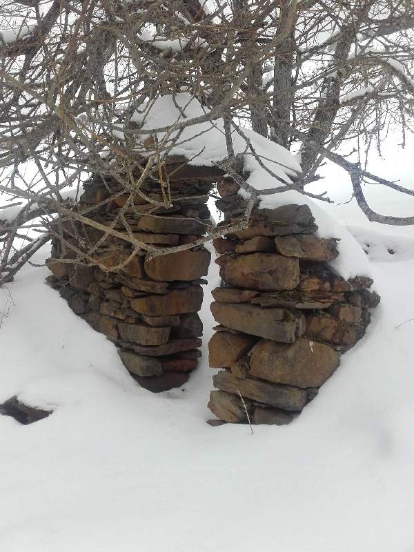
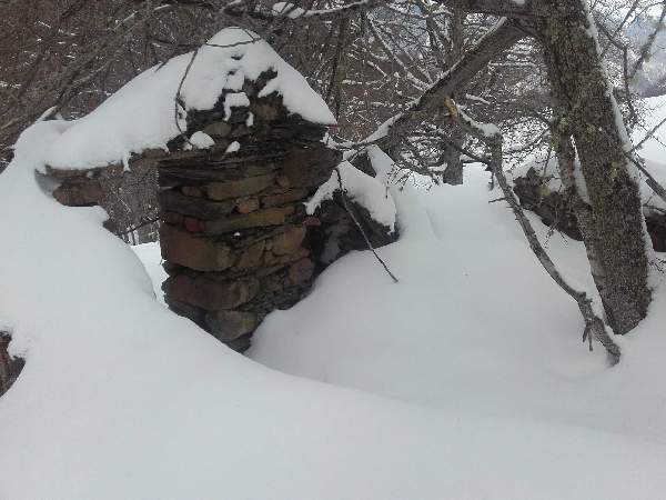
En ruine. Il ne reste qu'un pan du mur pignon nord-ouest avec l'ancienne porte d'entrée.
Type : Ruine
Altitude : 1370
Carte 1/50 000 : Carte N°22 Pica d'Estats - Aneto Carte N°5 Luchon
Carte 1/25 000 : 1848 OT Bagnères-de-Luchon Lac d'Oô
Propriétaire :
Gardien :
Internet :
Période :
Tel :
Capacité été : 0
Capacité Hiver : 0
Cheminée :
Bois :
Eau :
Couchage :
Idée Rando : Pic Burat/ Bacanère / boucle par étangs de St Béat
Derniere visite : 2016-03-12
Latitude : 42.868333
Longitude : 0.64249999
Cabane de Plagnette (Baren) à 0.78 Km de distance
Cabane Salode à 1.478 Km de distance
Cabane de l'Artigue de Burgalays à 1.612 Km de distance
Cabane Burat à 1.69 Km de distance
Lac de Burat 2.113 Km de distance
Etangs de dessus et de dessous 3.057 Km de distance
Etang de St-Beat 3.456 Km de distance
Etang de Sasplays 6.89 Km de distance
Lac de Bordères 14.804 Km de distance
Plan de Montmajou depuis Artigue
Boucle d'Élodie au départ de Burgalays
Le Val de Burat et le Hêtre de Marignac
Pic du Gar et Pic Saillant par le Col de Teyech puis le Col de Caube
Petite boucle au Mail de la Pique
Tuc des Pans
Boucle d'Argut
Boucle au départ de Saint-Paul-d'Oueil
Sommet de l'Oudérou depuis Binos
Boucle de Saint-Béat-Lez à Fos
Boucle par la cabane de Saunères depuis Artigue
Pic de Burat par Marignac
2015-03-14
Cette cabane n'existe plus depuis longtemps. Carte IGN fausse. Visitée par le Géomètre du Cadastre en 09 2013.
2009-11-23
Cabane inexistante en ruines